 |
 |
 |
 |

Welcome! th visitor.(since Jun.19,1996)
|

Welcome! |

|
KASHMIR 3D Ver 8.0.9 Beta available (Mar.23,2004) Download now. This is Beta Version. Fixed bugs. |

|
KASHMIR 3D Ver 8.0.8 Beta available (Mar.11,2004) Download now. This is Beta Version. Two new plugins (SRTM plugin and USGS Map plugin) were released together. They are included in this package. |

|
KASHMIR 3D Ver 6.13 available (Jul.30,2000) Download now. Kashmir was appended many features. Kashmir supports for DHM25! (Digital Height Model of Swisstopo) |
 Fixed bugs. Kashmir 3D Ver 5.52 available! Update now!. (Jan.29)
  With new CG technology Kashmir 3D Ver 5.51 available! (Dec.24)
  User's manual available! Online manual is Here!. (Dec.24)
  Upload new CG movie. Movie Gallery. (Dec.17)
  Renewal of CG Gallery. (Dec.17)
  Kashmir supports for RIMINI ! (Digital Height Model of Swisstopo)(Sep.2)
  Kashmir User's Board was opened.(May.15)
  |
 |
 |
 |
 |
 |
 |
 |
 |
 |
 |
 |
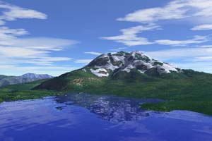
Å@About Kashmir.. It's a software for making landscape CG or amuzing 3D maps. You can render a beatiful landscape CG on your PC. You can use USGS's DEMs, Grayscale Bitmaps and so on. You can know which mountain you can see from your home. Support for 3D Navigation by GPS Receiver. Support for Full-Raytracing rendering and Z-Buffer rendering. Support for rendering clouds, fog, snow and mist. Support for depth of focus. Å@Kashmiris a free software for Windows95,98,WindowsNT 4.0,2000 or later. |
 |
 |
 |
 |
 |
 |
 |
WEB
KASHMIR 3D
3D Landscape CG
Other Contents
|

|
mail to Kashmir 3D: MAIL
This site is link free!
Please use the following url.http://www.kashmir3d.com/
Please use this banner
This page was made width Japan Geographical Survey 50m mesh size 'Japan-2'.
Created Dec.2,1995. Last modified
02.Feb,2002
